🚚 Free Worldwide Shipping on All Orders!Shop Now
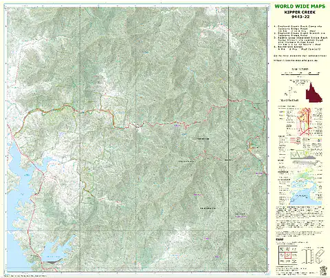
World Wide Maps Kipper Creek Bush Walks Map
This A1 size paper topographic map at 1:25,000 scale, replaces the old published map (1992).
The standard topo map has been enhanced by World Wide Maps with 4 bush walks highlighted.
1. England Creek Bush Camp via Joyners Ridge Road
2. England Creek (right branch) via Joyners Ridge Road
3. Aquila Loop (England Creek Bush Camp Circuit)
4. Northbrook Gorge
The map covers part of South D’aguilar National Park, Brisbane Forest Park.
$6.06
Original: $17.31
-65%World Wide Maps Kipper Creek Bush Walks Map—
$17.31
$6.06Product Information
Product Information
Shipping & Returns
Shipping & Returns
Description
This A1 size paper topographic map at 1:25,000 scale, replaces the old published map (1992).
The standard topo map has been enhanced by World Wide Maps with 4 bush walks highlighted.
1. England Creek Bush Camp via Joyners Ridge Road
2. England Creek (right branch) via Joyners Ridge Road
3. Aquila Loop (England Creek Bush Camp Circuit)
4. Northbrook Gorge
The map covers part of South D’aguilar National Park, Brisbane Forest Park.